From Tim De Chant’s Per Square Mile blog:
Last week, I wrote about how urban trees—or the lack thereof—can reveal income inequality. After writing that article, I was curious, could I actually see income inequality from space? It turned out to be easier than I expected.
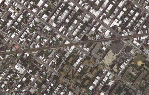
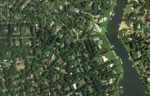
He makes some interesting comparisons from satellite images of cities around the world. Here is where I live in Bushwick, Brooklyn compared with the place in New York State with the highest per-capita income, Hewlett Bay Park.
Link via BoingBoing