-
Neil Freeman interviewed about his Electoral College Reform map
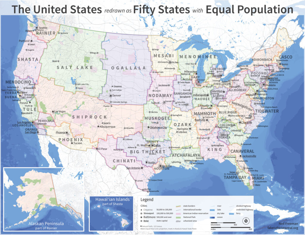
You may have seen Neil’s map before, where each of the US’s 50 states are redrawn to balance for population. It’s nice to see his project’s motivating ideas laid out like they are in this Paris Review interview:
I think that the biggest cultural change would be with the profusion of city-states. Many states overrepresent rural areas when it comes to divvying up funding for infrastructure projects and other spending. The alignment of metro areas and states would mean that decision-making power in land use and transportation would shift away from rural areas, which would probably mean less sprawl and more livable cities.
See also: Neil’s 50 states and 50 metros
The fifty largest metro areas, disaggregated from their states. Each has been scaled and sorted according to population.